


Description
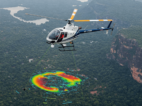
🧭 Geophysical Surveys by Helicopter
Our helicopter-based geophysical surveys provide accurate, efficient, and non-intrusive data collection for resource industries and environmental analysis.
Why Choose Helicopter-Based Surveys?
✔️ High-Precision Data – Magnetic, radiometric & EM sensors for deep insights
✔️ Large-Area Coverage – Fast and comprehensive mapping of rugged landscapes
✔️ Low Environmental Impact – Minimal ground disturbance in sensitive zones
Applications Include:
⛏️ Mineral & Oil Exploration
🗺️ Geological Mapping & Fault Line Analysis
💧 Environmental & Groundwater Studies
🌟 Why Choose Trans Bharat Aviation Pvt. Ltd.?
✔️ DGCA-Approved & Trusted – Operated under the highest aviation standards
✔️ Cutting-Edge Tech & Skilled Crew – Precision-focused, safety-first operations
✔️ Customized Aerial Solutions – Flexible, client-specific service design
✔️ Pan-India Reach – Rapid deployment, wherever your project needs us
📞 Contact Us Today!
📧 contact@transbharat.in
🌐 www.transbharat.in
☎️ +011- 45665643


Reviews
There are no reviews yet.